|
Agriculture in Alexandria
The surface area of agricultural land in Egypt remained at about six million acres for a number of years. However, in recent years the great increase in population has led to a decrease in agricultural land because vast areas of it have been used for urban expansion projects.
In view of this, the objectives of the report by Alex Med on Agriculture in Alexandria were:
- To establish a digital database of the agricultural infrastructure, showing irrigation canals, drainage channels, roads, and villages located on agricultural land.
- To identify slums resulting from the illegal appropriation of agricultural lands for the construction of buildings.
- To identify different land uses in Alexandria.
- To identify changes in the surface area of agricultural land in the Governorate of Alexandria using remote sensing and geographic information system (GIS).
- To make an economic analysis of agricultural sector in the Governorate of Alexandria in order to determine its contribution to the gross agricultural production of Egypt.
.jpg)
Irrigation Network in Alexandria
The State of the Environment in Alexandria
The main goal of the Alexandria and Mediterranean Research Center’s report on The State of the Environment in Alexandria was to provide the most recent information and to implement a database accessible to decision makers and researchers.
The issue of environmental preservation is a global concern at both the international and national level. Egypt as a developing country is facing many environmental problems due to rapid population growth, unplanned land use distribution and unplanned extension of human activity. Industry, transportation and energy production are major contributors to pollution. Environmental deterioration is affecting the natural resources of Egypt. Moreover, untreated or poorly treated urban and industrial effluents also endanger the environment, and human health and welfare. Canals increasingly suffer from eutrophication, weeds and the accumulation of pesticides, which in turn lead to the contamination of drinking water. Similarly, the discharge of nutrients and chemicals into the sea has a negative impact on Egypt’s shores and coastal fishing and is a potential threat to tourism. Soil salinity and water logging affect the productivity of agricultural land and contribute to the production of contaminated crops.
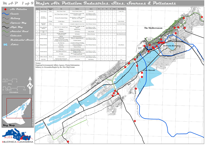
Major Sources of Air Pollution in Alexandria
In view of all these issues, the objectives of The State of the Environment in Alexandria report were:
- Outlining the various aspects of the environment in Alexandria;
- Identifying sources of pollution and major pollutants in Alexandria;
- Determining pollution zones in Alexandria;
- Forming a comparison between the degree of pollution in Alexandria and the International Pollution Guidelines and Standards;
- Studying the regulatory setting, forms of governmental intervention in Alexandria and the effectiveness of the environmental law and legislation;
- Identifying potential pollution sites in Alexandria in addition to pollution avoidance and minimization measures.
Housing in Alexandria
The report on Housing in Alexandria assesses the current situation of both urban and informal housing. It examines the data with emphasis on the historical background.
This report also includes vital information on the administrative boundaries of the city, the types of housing and their condition, land values, demographic data, and the potential for urban extensions. It also discusses the national legal framework for housing and Alexandria governorate’s authorizations granted to build housing. Moreover, the report includes an annex on the main factors effecting the price of housing units.
.jpg)
Alexandria Districts, Sectors and Shiakhat
Industry in Alexandria
Alex Med’s study on Industry in Alexandria aimed to provide decision makers with a report containing the most recent data from a variety sources in order to aid the decision making process.
Industry plays a fundamental role in the city’s economy. Moreover, it is the foremost cause of air, noise, and water pollution and has an explicit and implicit influence on the built environment. The objective of this study was also to identify land occupied by industry and to estimate its market value. This aim stemmed from the highly fragmented nature of the distribution of industries in Alexandria, and from the lack of information or an up-to-date database on the areas concerned.
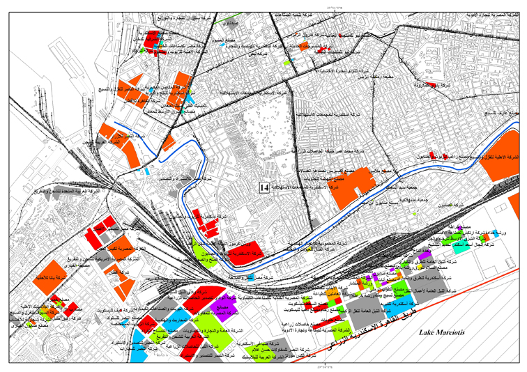
Factories in Alexandria Classified by ISIC
Land Divisions in Alexandria
The study of land divisions included a report on each of the seven districts of Alexandria. The objectives of this study were to report on urban growth and the establishment of new areas in the city, from the end of the nineteenth century until the present day. The study also evaluated developments such as the addition of services and utilities, the proportion of vacant lands, green spaces and apartment blocks, and the effect of these on the quality of life. Other objectives were to study the role played by the planning authorities such as the Ministry and the Municipal Council and to develop regulations for the construction and restriction of land division.
A wide range of resources were used for this study including the Alexandria Governorate archives, the Municipal Library, a variety of terrestrial maps, and documents from construction companies.
Land Division Sample
The Mahmoudieh Canal Report
In January 2007, the governorate of Alexandria requested the Alex Med center to conduct a preliminary study for the improvement and development of the road along the northern bank of the Mahmoudieh Canal. The overall objective was to transform this road into a new route for traffic travelling along the east-west axis of the city, thereby decreasing traffic density within Alexandria. This preliminary study focused on the stretch of road between Antoniadis Gardens and Namoos Bridge. The study included a survey of land use, existing problems and an analysis of the condition of the road. Stretches of the road which could be widened and areas which should be expropriated were identified. The outcome of the study, including recommendations and proposals, was submitted in a report to the governorate of Alexandria.
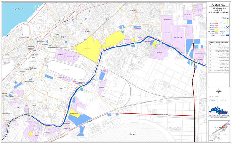
Mahmoudieh Canal - Land Uses
Public Utilities in Alexandria
The capacity of the public utilities network of a city in relation to its population is a key factor of economic and social development. The report on the public utilities network in Alexandria had the following objectives:
- To provide the latest accurate data on public utilities in Alexandria for researchers and decision makers.
- To assess the present potential of public utilities and whether they meet the needs of the population.
- To compare the development of this potential and actual performance over the past few years.
- To compare the per capita share of each utility with International Standards.
- To demonstrate the classifications of utility charges applied according to the categories of citizens and the quality of the services provided.
Electricity Usage Percentages in Alexandria
Tourism in Alexandria
Tourism is one of the fastest growing industries worldwide. Alexandria has an abundance of touristic attractions due to partly to its unique geographical location in the Mediterranean and to its climate, which qualify it to play a major role in the tourism industry.
The objective of the report on tourism in Alexandria was to set up a database on the touristic facilities in Alexandria using the international norms established by the World Tourism Organization (WTO) which follows the Standard International Classification of Tourism Activities (SITCA). This database is intended to compensate for a lack of information in this field.
Existing Touristic Facilities in Alexandria
Touristic Housing in Alexandria
The report on Touristic Housing in Alexandria discusses the current situation of touristic accommodation along the north west coast of Alexandria governorate. It firstly examines the tourist resorts along the International Coastal Road (between Alexandria and Matrouh) along the stretch of road between 34 km and 106 km west of the city of Alexandria.
The report discusses the classification of these resorts and includes a field survey on the value of touristic units and areas, as well as an analysis of the built-up areas inside the resorts. A detailed study of each resort was completed, illustrating the number of units and areas, in addition to an overall analysis of all the resorts. The report also includes a study of existing hotels in the area, examining their location, star rating, size and prices. Finally, the report emphasizes the need to conform to the legal framework when constructing new resorts along the north west coast.
.jpg)
Location of Touristic Housing in Alexandria
Transportation in Alexandria
Alexandria is the second largest economic division and the largest port in Egypt, as well as being a major industrial city and prime summer destination for domestic tourism. Alex Med’s report on Transportation in Alexandria focused on the urban transportation systems including entrance roadways to the city and the urban road network within the city itself. It evaluated both the traffic behavior on the major roads and the deficiencies of the network.
The study of public transport centered on the condition and distribution of the bus and tram networks in the city, and on the national railway network including the Alexandria/Cairo railway, the Abu Kir regional railway and the Alexandria/Matrouh railway. The report examined the private bus networks such as those run by schools, tourism and businesses. It also included air transport via El Nouzha and Borg El Arab airports. The objectives of this report also covered travel behavior on both public (tram and bus) and private (motorization) transport.
The Transportation in Alexandria report aimed to provide the most recent information for decision makers and, in particular, to focus on the transportation policies to be implemented as part of the Alexandria Comprehensive Development Plan of 2005.
Transportation Network in Alexandria
A Study of Parking Areas in Alexandria
In April 2007, Alex Med conducted a preliminary study of the parking areas in Alexandria, requested by the Governorate of the city. This study investigated the causes of the parking problems and proposed preliminary solutions. The parking problem is the result of urban densification, improper land use and the conversion of residential apartments into business enterprises. The study also pointed out the location of public garages and parking areas, it highlighted the vacant areas that could be used for parking, and the streets that might be partially suitable for parking at certain hours of the day. The study concluded with short, medium, and long term recommendations to solve the problem and the final report was submitted to the Governorate of Alexandria.
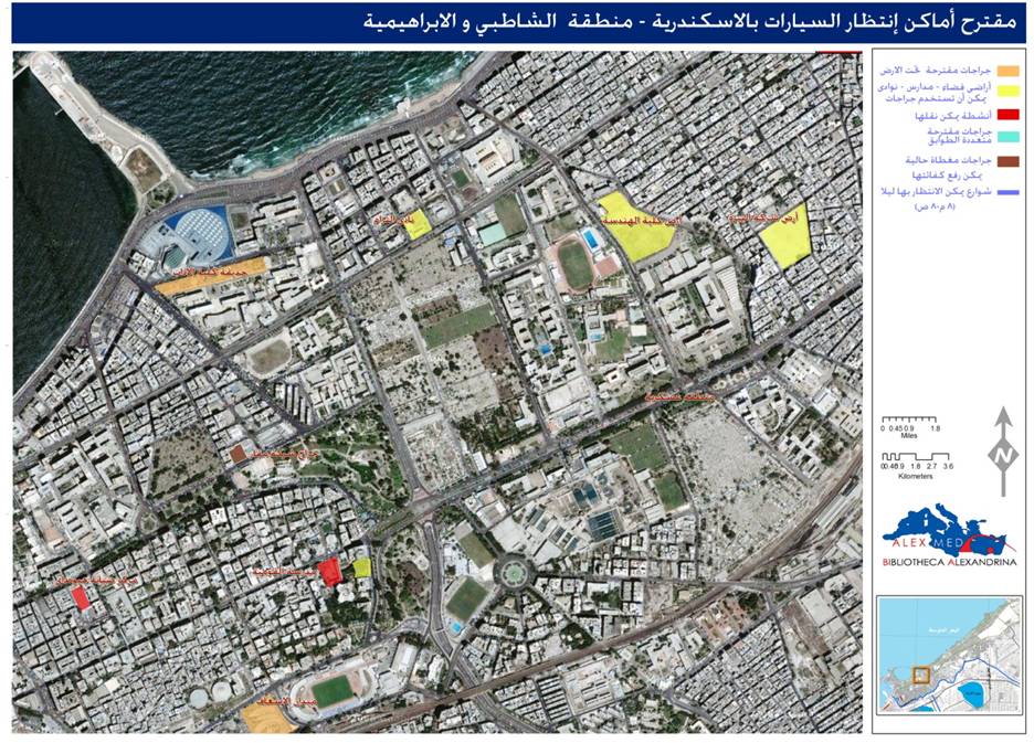
Suggested Parking Places in Chatby Area
|